
Groundbreaking Insights into Pricing LEO Satellite IoT Data: Is Geography a Game Changer?
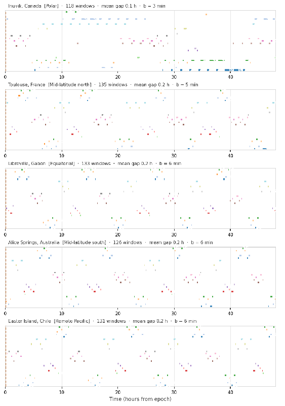
A recent study sheds light on how geography and satellite configuration profoundly affect the pricing of Internet of Things (IoT) data transmitted through Low Earth Orbit (LEO) satellites. This research introduces crucial concepts such as the "pricing cliff" phenomenon and geographical pricing premiums, challenging traditional models of data valuation in satellite communications.
Understanding the Pricing Cliff Phenomenon
The study reveals that the price of IoT data delivered via LEO satellites isn't smooth but rather exhibits a "pricing cliff" characteristic. Essentially, as buyers specify higher completeness thresholds for data delivery (for example, needing 90% of the data versus 80%), the price they are willing to pay can drop significantly. This decrease occurs not due to differences in data value but because of the inherent store-and-forward structure of LEO satellite communication. Data is only delivered when the satellite passes a ground station, creating discontinuities in pricing depending on when and how much data can be delivered.
The Impact of Geography on Pricing
One of the study's most compelling findings is the geographical pricing asymmetry based on latitude. Polar regions receive more satellite passes than equatorial areas, leading to faster data delivery from polar terminals compared to their equatorial counterparts. The research illustrates that increasing the number of satellites in a constellation significantly diminishes this pricing gap. In fact, going from just one satellite to 25 can reduce the pricing premium between polar and equatorial regions by a staggering 25 times.
For instance, at full constellation size, the geographic pricing premium falls below 1% of the peak data value. This reduction emphasizes the importance of satellite density for equitable pricing across different geographical locales, aspiring to ensure fair access to data for all users, regardless of their location.
Revolutionizing IoT Data Pricing Models
This integrated pricing model combines orbital simulation with a buffer flow model and a data decay valuation framework based on market prices, offering a comprehensive approach to understanding satellite-based data pricing. It articulates not only the structural differences in latency between polar and equatorial terminals but also quantifies the urgency that different types of buyers might experience. For example, emergency responders need data with swift urgency, while agricultural planners may have more flexible timelines.
Conclusion and Future Directions
The implications of this research are significant, paving the way for more accurate and equitable pricing strategies in LEO satellite communications. As connectivity expands to remote regions, understanding how satellite configuration and geography impact pricing will be crucial for stakeholders aiming to optimize data delivery and revenue generation. Future exploration could focus on calibrating these models with real-world pricing observations, potentially transforming how satellite data markets function.
In summary, this innovative research not only highlights the complexities within pricing models for satellite-delivered IoT data but also sets the stage for future advancements aimed at bridging the gaps in digital equity.
Authors: Rahul Ramachandran, Suman Banerjee, University of Wisconsin–Madison


